
Why it’s here: read one marker before reading the whole map
Trenísimo España is a browser map that makes it easy to compare how Spanish rail services are displayed. NavSprout selected it for a short map-reading exercise: find one train and work out what its marker represents. Start with a single corridor or service so that a busy map does not get in the way of reading the train’s details.
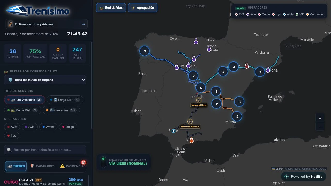
| Control | What it does | What to look for |
|---|---|---|
| Filtrar por Corredor / Ruta | Pick one route or corridor. | A smaller set of markers makes it easier to identify a train. |
| Tipo de servicio | Choose a service such as Cercanías or Alta Velocidad. | Filter the traffic before trying an operator or station search. |
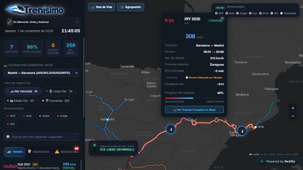
| Telemetría | Read the source inside the train popup. | The label can describe a Renfe feed or a schedule-model estimate. |
| Red de Vías | Toggle the line overlay. | Compare the marker on its own with the railway network underneath. |
Why start with a corridor instead of all of Spain?
The route filter gives you a boundary for the exercise. Choose a familiar area, then try a station or operator in the search field. Once you have one candidate, open the train detail and note its service, route and source label. That gives you a useful result even if the map has only a few relevant trains at the time.
How can you compare two markers?
Try one Cercanías marker and one Iryo or Ouigo marker if both are visible. Cercanías can draw on the Renfe commuter feed. The code generates Iryo and Ouigo estimates from a model, so they may appear beside feed-derived points. Look for the source label rather than judging by movement or color. If the feed is unavailable, use the simulation to practice finding the controls.
What can you learn from the distance radar?
Radar Dist. is an optional second step after you understand a marker. The tool shows computed distances and proximity examples. Its published notice describes those alerts as educational calculations. An alert in the map is a prompt to inspect the visualization, while real rail updates belong to the operator or infrastructure manager’s channels.
What counts as a useful first visit?
Finish with a short note containing the train or route, the filter you used and the type of source reported for the marker. A train that is missing from the current view may reflect the filter, feed coverage or fallback behavior. The public code and endpoints were reviewed on November 7, 2026. This guide does not confirm a particular service’s position, timetable or arrival.
Try this: filter one route and read the source
- Choose one corridor or switch the service filter to Cercanías.
- Open one train marker and note the operator and route.
- Find the Telemetría label if present, and write down whether it refers to a feed or an estimate.
- Toggle Red de Vías to see how the displayed route helps you interpret the map.
Trenisimo Netlify app FAQ
What can I do with Trenisimo?
Explore Spanish railway routes, narrow the map by corridor or service and inspect train details and their source labels.
What does Horario Estimado por Modelo mean?
The service is shown using a model-based schedule estimate. The app uses this label for generated Iryo and Ouigo entries.
Why might a train be missing?
Filters, feed coverage and the time of the visit can all affect what appears. Reset the filters and check the operator’s own information for a specific journey.
Do I need an account to open the map?
The reviewed public map and its entry controls were available without a sign-in screen.
Sources and review scope
- Trenísimo España map ↗
- Trenísimo simulation and data notice ↗
- Trenísimo feed and fallback implementation ↗
- Renfe passenger information ↗
- Adif rail infrastructure information ↗
We reviewed the map in a browser, the simulation notice, deployed code and public endpoint responses. Individual train movements and incident claims were outside the review.